
Kashaeva Yu. A. Cartographic heritage of the 18–20th centuries in the repositories of the Perm Region (characteristics, formation, use)
Yulia A. Kashaeva
Candidate of Historical Sciences, Perm National Research Polytechnic University; State Archive of Perm Krai
Perm, Russia
E-mail: jkashaeva@mail.ru
ORCID: 0000-0002-0102-3373
![]() Скачать | Back to the Content № 1. 2022
Скачать | Back to the Content № 1. 2022
УДК 94(470.5)”17/19”:930.25
DOI: 10.58529/2782-6511-2022-1-1-100-113
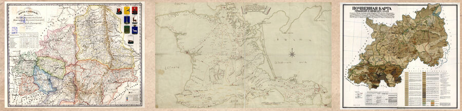
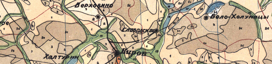
ABSTRACT. The article gives a description of the repositories of cartographic sources of the Perm region — archives, museums and libraries. The issues of acquisition of cartographic funds are studied, the sources are described by thematic composition, chronological framework, technique of execution. The history of the cartographic archive of Ivan Yakovlevich Krivoshchekov, a Ural geographer and cartographer of the late 19th — early 20th centuries, is revealed, which includes documents on the territory of the Perm province and, in a small amount, Russia. Transferred in 1918 to the library of the Perm State University, the archive was subsequently divided into three repositories and, unfortunately, has not been preserved in full. In 2017, the preserved maps and plans from I. Ya.Krivoshchekov’s archive was digitized and became publicly available on the website of the project “Preservation, study and popularization of the heritage of the Ural cartographers of the mid-18th — early 20th centuries”. The article focuses on the use of maps and plans in digital projects of Russian researchers aimed at empowering users to gain access to documents. The exhibition activity of museums, archives and libraries, including that in virtual space, is presented. The publishing activity of custodian institutions is a rare practice due to a number of reasons, primarily the lack of financial and human resources. The composition of the cartographic collections of large repositorie — the State Archives of the Perm Territory and the Perm Museum of Local Lore — is considered in more detail. The article defines the prospects for further introduction into scientific circulation of cartographic sources from the funds of institutions in the Perm region.
KEYWORDS: cartography, surveying, storages, historical and cultural heritage, map, I. Y. Krivoshchekov
For citation: Kashaeva Yu. A. Cartographic heritage of the 18–20th centuries in the repositories of the Perm Region (characteristics, formation, use) // Historical Geography Journal. 2022. Vol. 1. № 1. P. 100–113.
REFERENCES
- Balyberdina P. A. [Overview of Perm city plans stored in State Archive of Perm region]. Ot karty proshlogo — k karte budushchego: collection of scientific papers [From the map of the past to the map of the future: a collection of scientific papers]. Perm: Perm State National Research Univ. Publ., 2017, vol. 3, pp. 8–12. (in Russ.).
- Barinova T. V. [I. Y. Krivoshchekov’s Legacy in the Scientific Library of Perm State National Research University]. Ot karty proshlogo — k karte budushchego: collection of scientific papers [From the map of the past to the map of the future: a collection of scientific papers]. Perm: Perm State National Research Univ. Publ., 2017, vol. 3, pp. 13–18. (in Russ.).
- Bushmakov A. V. [Publication of archival documents in electronic form]. Gosudarstvennyy arkhiv Permskogo kraya [State Archive of Perm Region]. Available at: http://www.archive.perm.ru/projects/articles-and-publications/1116124-the-publication-of-archival-documents-in-electronic-form/?special_version=Y. (accessed: 24.12.2021). (in Russ.).
- Buzunova S. G. [The activities of UOLE — SOKM for the formation and popularization of the cartographic collection]. Ot karty proshlogo – k karte budushchego: collection of scientific papers [From the map of the past to the map of the future: a collection of scientific papers]. Perm: Perm State National Research Univ. Publ., 2017, vol. 3, pp. 19–28. (in Russ.).
- Demina I. V. [Overview of cartographic documents in the collections of the State Archive of the Perm Region]. Ot karty proshlogo — k karte budushchego: collection of scientific papers [From the map of the past to the map of the future: a collection of scientific papers]. Perm: Perm State National Research Univ. Publ., 2017, vol. 3, pp. 39–43. (in Russ.).
- Frolov A. A., Golubinskii A. A., Kutakov S. S. [Web GIS “Drawings of the Russian state of the XVI–XVII centuries” (http://rgada.info/geos2)]. Istoricheskaya informatika [Historical informatics], 2017, no. 1 (19), pp. 75–84. DOI: 10.7256/2306-0891.2017.1.22025 (in Russ.).
- Golyasheva M. A. [Providing WEB access to cartographic collection of the Russian State Library]. InterKarto. InterGIS [InterCarto. InterGIS], 2013, no. 19, pp. 154–157. DOI: 10.24057/2414-9179-2013-1-19-154-157 (in Russ.).
- Horohordin G. S. [Cartographic collection of printed maps of Siberia, the turn of XIX—XX centuries state archive of the Altai region]. Interekspo Geo-Sibir [Interexpo Geo-Siberia], 2016, vol. 6, no. 1, pp. 46–50. (in Russ.).
- Iakovlev V. O. [Russian geographical drawings of the 17th century in the St. Petersburg archives and libraries]. Peterburgskii istoricheskii zhurnal [Petersburg historical journal], 2021, no. 1 (29), pp. 24–44. (in Russ.).
- Kashaeva Yu. A. [Collection “Maps and plans” of the Perm Museum of Local Lore: characteristics, description and prospects of use]. Ot karty proshlogo — k karte budushchego: collection of scientific papers [From the map of the past to the map of the future: a collection of scientific papers]. Perm: Perm State National Research Univ. Publ., 2017, vol. 3, pp. 58–65. (in Russ.).
- Kashaeva Yu. A. [I. Y. Krivoshchekov’s cartographic collection in the Fundamental Library of Perm State Pedagogical University]. Universitet i biblioteka. Vmeste 90 let: sbornik materialov regionalnoy nauchno-metodicheskoy konferentsii, g. Perm, 21 sentyabrya 2011 g. [University and library. Together for 90 years: a collection of materials of the regional Sci. and methodological conf.]. Perm: Perm State Pedagogical Univ. Publ., 2012, pp. 16–22. (in Russ.).
- Kashaeva Yu. A., Pyankov S. V. [About the project “Preservation, study and popularization of the heritage of cartographers of the Urals in the mid-18 — early 20th centuries”]. Ot karty proshlogo — k karte budushchego: collection of scientific papers [From the map of the past to the map of the future: a collection of scientific papers]. Perm: Perm State National Research Univ. Publ., 2017, vol. 3, pp. 46–55. (in Russ.).
- Kationov O. N., Smagin R. Yu., Voronina A. A. [Handwritten maps of Siberia of the 18th — early 20th century in archives, museums and libraries of Russia]. Gumanitarnye nauki v Sibiri [Humanitarian sciences in Siberia], 2012, no. 3, pp. 53–56. (in Russ.).
- Kornienko M. V. [Cartographic sources of the 19–20th centuries in the funds of the Kurgan Museum of Local Lore]. Zyryanovskie chteniya: materialy Vserossijskoj nauchno-prakticheskoj konferencii [Zyryanov readings: materials of the All-Russ. Sci. and Pract. Conf.]. Kurgan: b. i., 2017, pp. 176–179. (in Russ.).
- Krasnikova O. A. [How the cartographic collection of the Library of the Russian Academy of Sciences was formed]. Peterburgskaya bibliotechnaya shkola [St. Petersburg Library School], 2018, no. 2 (62), pp. 57–59. (in Russ.).
- Kusov V. S. Zemli bolshoy Moskvy: kartograficheskie proizvedeniya XVII–XVIII stoletiy [Lands of greater Moscow: cartographic works of the 17–18th centuries]. Moscow: Russkiy mir Publ., 2008. (in Russ.).
- Kusov V. S. Moskovskoe gosudarstvo XVI — nachala XVIII veka: svodnyy katalog russkikh geograficheskikh chertezhey [Moscow state of the 16th — early 18th centuries: a consolidated catalog of Russian geographical drawings]. Moscow: Russkiy mir Publ., 2007. (in Russ.).
- Mekhonoshin D. A., Kashaeva Yu. A. [Localization of repositories of cartographic materials in the Urals]. Ot karty proshlogo — k karte budushchego: collection of scientific papers [From the map of the past to the map of the future: a collection of scientific papers]. Perm: Perm State National Research Univ. Publ., 2017, vol. 3, pp. 85–91. (in Russ.).
- Roschevskaya L. P., Konovalova E. N., Zagorodnuk N. I. [Cartographic documents of the XVIIth — the beginning of the XXth centuries in the collection of the Tobolsk Historical and Architectural Museum-Reserve: the history of gathering and the present state]. Otechestvennye arhivy [Domestic Archives], 2016, no. 6. pp. 29–35. (in Russ.).
- Rudniki Pyskorskogo medeplavilnogo zavoda [Mines of the Pyskor Copper Smelter]. Usole: Usolskiy istoriko-arkhitekturnyy muzey «Palaty Stroganovykh» Publ., 2018. (in Russ.).
- Shpakova M. V. [Maps and atlases of the 18–19th centuries in the fund of the Perm State Regional Universal Library named after A. M. Gorky]. Ot karty proshlogo — k karte budushchego: collection of scientific papers [From the map of the past to the map of the future: a collection of scientific papers]. Perm: Perm State National Research Univ. Publ., 2017, vol. 3, pp. 122–127. (in Russ.).
- Smirnov N. I., Abdullin R. K., Kashaeva Yu. A., Foteeva P. S. [The development of a web-resource “Heritage of the Ural cartographers of the mid-18th — early 20th centuries”]. Geograficheskiy vestnik [Geographical Bulletin], 2018, no. 3 (46), pp. 115–126. (in Russ.).
- Vishnevskiy B. N. Geograf-kraeved I. Ya. Krivoshchekov [Geographer-local historian I. Y. Krivoshchekov]. Perm: Permskoe knizhnoe izdatelstvo Publ., 1961. (in Russ.).
- Zinchuk L. N. [Cartographic collection of the Russian State Library]. Geoprofi [Geoprofi], 2007, no 6, pp. 4–8. (in Russ.).