
Yashkov I. A., Surkov D. A. Khanty-Mansi Autonomous Okrug — Yugra in the Mirror of Historical Geography: A Survey of the Thematic Maps of the First Half of the 20th Century from the Collection of the Museum of Geology, Oil and Gas
Ivan A. Yashkov
Candidate of geographical sciences, Deputy Director of the Museum of Geology, Oil and Gas
Khanty-Mansiysk, Russia
E-mail: zamnr@muzgeo.ru
ORCID: 0000-0002-5212-5409
Dmitriy A. Surkov
Head of the Department of History and Ethnography, Museum of Nature and Human
Khanty-Mansiysk, Russia
E-mail: Surd85@mail.ru
ORCID: 0000-0002-9422-5029
![]() Download | Back to the Content № 2. 2022
Download | Back to the Content № 2. 2022
UDC 94 (571.122)”19”:912.43
DOI: 10.58529/2782-6511-2022-1-2-110-121
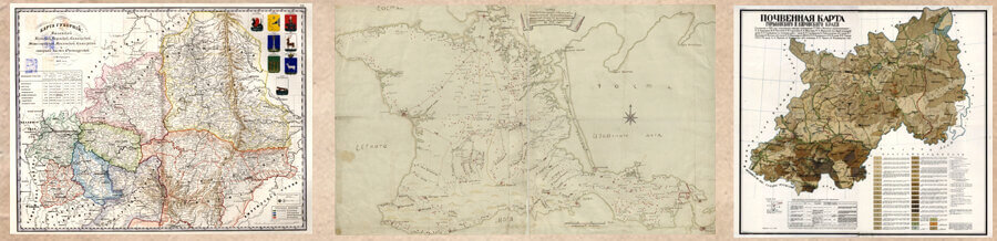
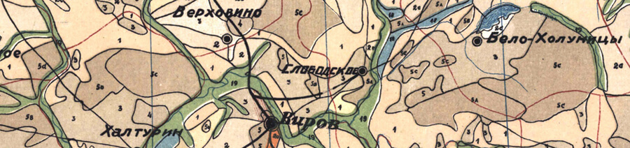
ABSTRACT. The article gives a brief survey of a set of 14 thematic maps of the late 1920s–1940s representing the territory of the modern Khanty-Mansi Autonomous Okrug — Yugra. This collection of electronic maps, which has been received by the Museum of Geology, Oil and Gas in 2020, is a unique cartographic source containing a valuable historical information on the region’s territory as regards of economy and nature management, land use and land tenure system, economic geography and geourbanistics, as well as geobotany, environmental history and other earth sciences and related disciplines. The maps are hand-made with the use of original design of the legend and the system of symbolic designation. These cartographic products are also of great scientific value, first of all, in connection to the historical geography. The preparation of the maps had been fulfilled at a time when there were no extensive topographic and geodesic works on the territory of Western Siberia, and expeditionary works and field surveys were not widespread. At that period, the region was characterized by the predominance of traditional economic forms of its indigenous inhabitants, as well as the development of agriculture, fishery and logging by special settlers. Today, these maps are of particular importance as they provide information for comparative analysis — since the beginning of the 1950s, the large-scale industrialization of the region began in connection with the discovery of the country’s largest hydrocarbon reserves and the start of exploitation of the West Siberian oil and gas province. This new period of the region’s development, which is lasting up to the present day, to a large extent transformed all previous forms of economic use of territory and radically changed the course of environmental history.
KEYWORDS: Khanty-Mansi Autonomous Okrug — Yugra, cartography, historical geography, Museum of Geology, Oil and Gas
For citation: Yashkov I. A., Surkov D. A. Khanty-Mansi Autonomous Okrug — Yugra in the Mirror of Historical Geography: A Survey of the Thematic Maps of the First Half of the 20th Century from the Collection of the Museum of Geology, Oil and Gas // Historical Geography Journal. 2022. Vol. 1. № 2. P. 110–121.