
Grishin E. S. , Semantics of the Historical Map. Constructing and Using Symbols for Historical Maps
Evgeniy S. Grishin
Institute of History and Archeology, Ural Branch of the Russian Academy of Sciences
Ekaterinburg, Russia
E-mail: bibliosof-info@yandex.ru
ORCID: 0000-0002-9521-2246
![]() Download | Back to the Content № 1. 2024
Download | Back to the Content № 1. 2024
UDC 528.96
DOI: 10.58529/2782-6511-2024-3-1-6-21
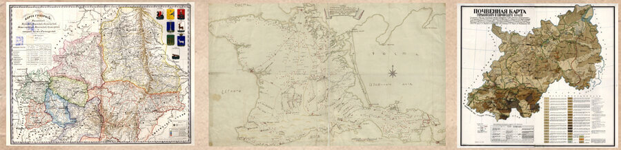
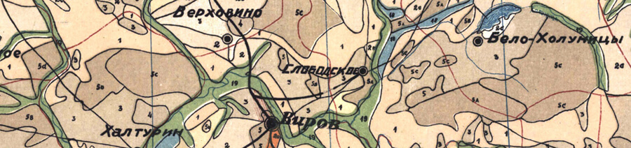
ABSTRACT. This article is devoted to the methodological and editorial issues of the formation and use of conventional signs when carrying out historical and cartographic work. It indicates the relevance of historical cartographic semantics, which usually does not receive proper reflection in works on the methodology for preparing historical maps. The author formulates the basic requirements for graphical means of the historical map in relation to their syntax, semantic compliance and general readability; provides the methodological basis for constructing and using symbols. Attention is paid to the structure of historical semantics and its individual blocks. A separate block of the article is devoted to the classification of signs and their areas of application. A description of the symbol resources is given. Sources of replenishment of symbols and mechanisms for the formation of new symbols are given. For each geometric type of symbol, an analysis of the various situations in which it can be used is presented; examples are given that reveal the informational and methodological potential of various techniques for using conventional signs. The article clarifies the concept of a reference base of symbols, which is a set of all available signs, grouped by thematic headings. The methodological provisions of the article are based on the practice of general and thematic mapping, as well as on the author’s personal profes- sional experience. The article is supplemented with examples of the thematic legends design, which can be used as a guide for the further accumulation of a reference base of symbols or for direct use when working with historical maps.
KEYWORDS: symbols, historical cartography, semantics.
For citation: Grishin E. S. , Semantics of the Historical Map. Constructing and Using Symbols for Historical Maps // Historical Geography Journal. 2024 Vol. 3 № 1 P. 6–21.
REFERENCES
-
Atlas of Medieval Europe. London; New York: Routlage, 1997 (In English).
-
Berlyant A. M. Kartografiya [Cartography]. Moscow: Aspekt Press Publ., 2002 (In Russian).
-
Bilich Yu. S., Vasmut A. S. Proyektirovaniye i sostavleniye kart [Design and mapping]. Moscow: Nedra Publ., 1984 (In Russian).
-
Grishin E. S. [The Reference Database of Symbols for Historical Maps: General Concept, Methodology and Application]. Istoricheskaya informatika [Historical Informatics], 2018, no. 1 (23), pp. 38–62. DOI: 10.7256/2585-7797.2018.1.25698 (In Russian).
-
Grishin E. S., Krutov D. A. [The Practice of Composing Regional Complex Historical Atlases]. Istoriko-geograficheskiy zhurnal [Historical Geography Journal], 2023, vol. 2, no. 1, pp. 44–59. DOI: 10.58529/2782-6511-2023-2-1-44-59 (In Russian).
-
Salishchen K. A. Kartovedeniye [Cartology]. Moscow: Izd-vo Moskovskogo unta Publ., 1990 (In Russian).
-
Timofeev V. A. Katalog uslovnykh znakov dlya sostavleniya kartograficheskoy dokumentatsii pri poiskakh, razvedke i razrabotke neftyanykh i gazovykh mestorozhdeniy [Catalog of Symbols for Compiling Cartographic Documentation for Searching, Exploration and Development of Oil and Gas Deposits]. Moscow: AO “TVANT” Publ., 1996 (In Russian).
-
Tipovyye uslovnyye oboznacheniya dlya tektonicheskikh kart [Typical Symbols for Tectonic Maps]. Moscow: S. n., 1997 (In Russian).
-
Vostokova A. V. Oformleniye kart [Maps Design]. Moscow: Izd-vo MGU Publ., 1985 (In Russian).